Strong Cold Front On the Way this Week
Following a fall front that crossed through South Florida Friday afternoon, that has unleashed very comfortable and pleasant conditions every since with the coolest morning...

Following a fall front that crossed through South Florida Friday afternoon, that has unleashed very comfortable and pleasant conditions every since with the coolest morning low Saturday morning since late March at Fort Lauderdale and since mid April at Miami!
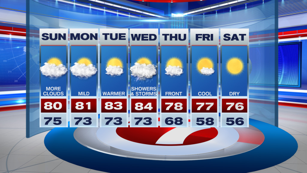
Unfortunately, for the cool weather fans, this Sunday morning is much warmer with widespread lows in the mid 70s due to an onshore breeze.
With this onshore breeze, that will draw in more clouds than sunshine throughout the day, which will hold highs down into the low 80s once again.

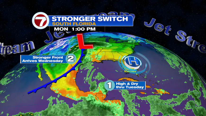
The first half of this week will feature a slight increase in highs, reaching the mid 80s Tuesday and Wednesday while lows hover above average in the mid 70s. It will remain likely dry with times of sun and clouds.

Then on Wednesday, a cold front will be approaching. This will usher in showers and thunderstorms, especially during the afternoon and overnight hours, and some of this moisture will be associated with the remnants of Tropical Storm Sara.

This will be our only notable rain chance over at least the next seven days, with high pressure and sunshine returning late in the week. This next front will contain even cooler air, however, with lows likely to fall into the 50s and highs only in the 70s on Friday and Saturday!

Tropics update
Tropical Storm Sara is nearing landfall on Belize this Sunday morning and is then forecast to dissipate on the Yucatan Peninsula by Monday, still bringing heavy rain to the region.
What's Your Reaction?


