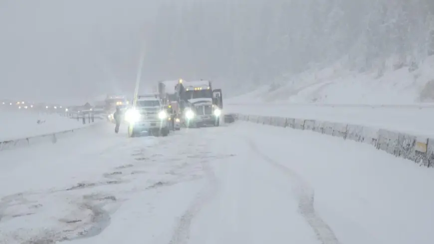
Snow totals from Colorado's widespread November storm near Denver metro area
Heavy, wet snow hit portions of Colorado's Rocky Mountains overnight Sunday as rain turned to snow and pushed east toward the Denver metro area.

DENVER (KDVR) — Heavy, wet snow hit portions of Colorado's Rocky Mountains overnight Sunday as rain turned to snow and pushed east toward the Denver metro area.
The storm is just starting for much of Colorado, but for others, over a foot of snow has been recorded. Major roadways, including Interstate 70, were closed in both directions are crews worked to remove cars and clear the pavement.
The Colorado Department of Transportation urged motorists to prepare for their Monday morning commute on Sunday, noting that 130 plows were out in the Denver metro area alone, including the I-70 corridor to the Eisenhower-Johnson Memorial Tunnel.
As of Sunday night, impacts at Denver International Airport were minimal: FlightAware was recording just three flight cancellations at the airport, and about 371 delayed flights.
How much snow fell on Sunday, Nov. 3, 2024
Here are the snow totals reported Sunday, Nov. 3, from 8 a.m. to midnight in Colorado.
County Location Inches of snow Boulder 1 SW Eldora 2 Clear Creek 1 WNW LOVELAND PASS 4.5 Clear Creek 1 WNW LOVELAND PASS 4.5 Grand 1 NNW BERTHOUD PASS 3 Grand 10 NNE SILVERTHORNE 6 Grand 5 WSW WINTER PARK 7.5 Grand 8 SSE RAND 4.5 Grand 9 SSE SPICER 4.5 Grand 1 NNW BERTHOUD PASS 3 Grand 10 NNE SILVERTHORNE 6 Grand 2 SSE Winter Park 5 Grand 5 WSW WINTER PARK 7.5 Grand 8 SSE RAND 4.5 Grand 9 SSE SPICER 4.5 Jackson 1 NNE RABBIT EARS PASS 3 Jackson 9 SSE GOULD 3 Jackson 1 NNE RABBIT EARS PASS 3 Jackson 9 SSE GOULD 3 Jefferson 1 S Crescent Village 7 LARIMER 4 NNW LONGS PEAK 4.5 LARIMER 6 E CAMERON PASS 3 Larimer 4 NNW LONGS PEAK 4.5 Larimer 6 E CAMERON PASS 3 PARK 3 WNW ALMA 6 PARK 7 E BLUE RIVER 3 PARK 9 SE WESTON PASS 3 Park 3 WNW ALMA 6 Park 5 SSW BLUE RIVER 6 Park 7 E BLUE RIVER 3 Park 9 SE WESTON PASS 3 SUMMIT 1 NW CLIMAX 10.5 SUMMIT 1 SSE LOVELAND PASS 1.5 SUMMIT 1 W COPPER MOUNTAIN 10.5 SUMMIT 5 SSW BLUE RIVER 6 SUMMIT 5 W GREEN MOUNTAIN RESE 3 Summit 1 NW CLIMAX 10.5 Summit 1 NW Dillon 6.8 Summit 1 SSE LOVELAND PASS 1.5 Summit 1 SSW Copper Mountain 15 Summit 1 W COPPER MOUNTAIN 10.5 Summit 3 SW Breckenridge 13 Summit 4 SSE Keystone 7 Summit 5 W GREEN MOUNTAIN RESE 3
More snow is anticipated throughout the week, and the heaviest impacts are anticipated from this storm overnight into Monday morning.
FOX31 Pinpoint Weather Meteorologist Liz McGiffin said that the morning commute could be difficult due to wet roads and some slushy accumulation in the metro. The evening commute should be fine: Snowfall is anticipated to wrap up in the afternoon.
However, keep an eye on the forecast: More showers could spread into the metro overnight Tuesday into Wednesday. This second storm is anticipated Stay tuned in with the FOX31 Pinpoint Weather Team for up-to-date forecast information.
What's Your Reaction?


