PICTURE PERFECT WEEKEND
Happy Friday, South Florida! Hopefully everyone had a great week. The work week across south Florida started as a chilly one as temperatures dropped into...

Happy Friday, South Florida!
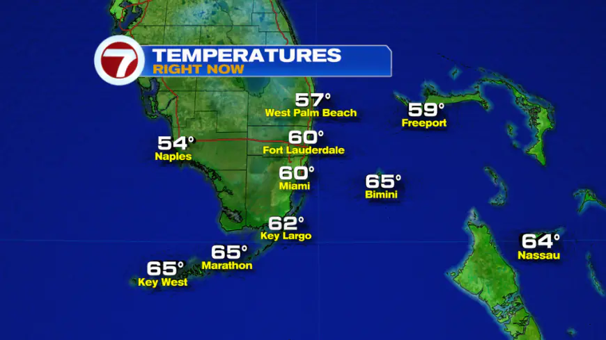
Hopefully everyone had a great week. The work week across south Florida started as a chilly one as temperatures dropped into the 40s and 50s for almost the entire week. And it wasn’t until yesterday where temperatures finally began to rebound a bit. Temperatures this morning were comfortably cool but nowhere near as chilly as it was earlier in the week. This morning South Florida started off with temperatures mostly in the 60s. A few inland areas of Miami-Dade and Broward managed to reach the upper 50s.

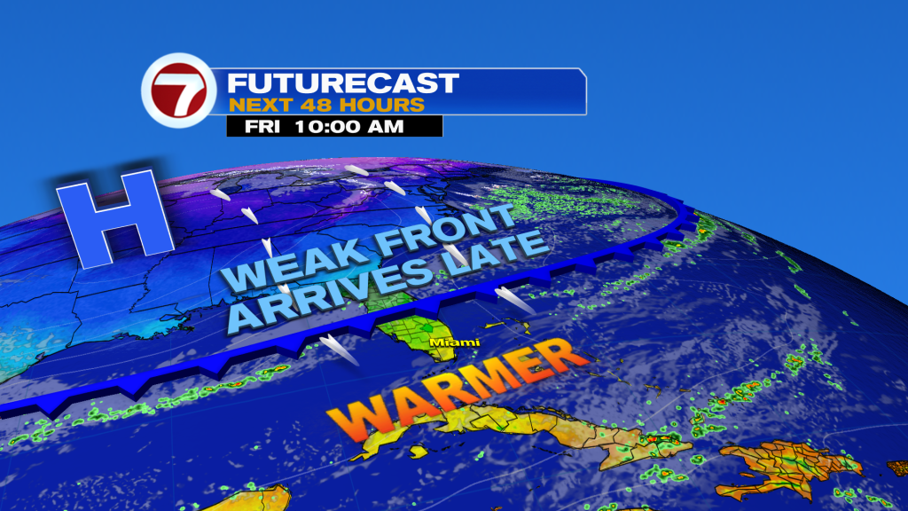
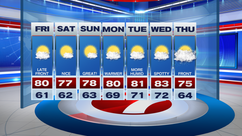
Today will likely be the warmest day of this week as our high temperatures will once again reach near 80° for the first time in a long time. It won’t feel warm though, because humidity levels still remain more on the comfortable side. And not everyone will hit 80° today. Some lucky portions of South Florida may remain in the upper 70s under a mix of sun and clouds. One thing worth noting is that a weak front will be pushing through the region late in the day today, which will keep comfortable conditions as we work our way into the weekend. But with limited moisture accompanying this front, it is unlikely to see any rainfall across the area.

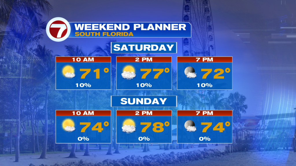
As mentioned above, the upcoming weekend looks to be a great one! The weak front pushing through South Florida later today will bring a reinforcing shot of ‘cool’ air across the region. So while South Florida will not see a significant cooldown this time around, today’s weak front will act as a reinforcer of keeping nice conditions across the area in the upcoming weekend. Plenty of sunshine will return this weekend as well as comfortable high temperatures in the upper 70s. Meanwhile, our mornings through the upcoming weekend will remain comfortably cool.

Looking ahead into early next week, South Florida will undergo some changes. These will be changes that we haven’t seen in quite some time. The area of high pressure that is forecast to keep nice conditions for us here through the upcoming weekend will finally begin to shift a bit farther east. The placement of this high-pressure system will cause our wind pattern to shift out of the southeast once again. This will usher in a warmer air mass across South Florida as humidity levels begin to rise. So while a spotty shower is possible through the first half of the week, it looks like the region will remain mostly dry during this time. That is, until the middle to end of the week when our next front possibly pushes through South Florida. Ahead of the front, temperatures will warm into the mid to lower 80s on Wednesday and cause higher humidity levels to return with the return of a south wind. A few showers cannot be ruled out heading into Thursday as the front pushes through South Florida. Unlike its predecessor, this front looks to bring cooler and drier air across the region heading into the following weekend. But there’s still plenty of time to see how it all plays out.

Have a wonderful 1st full weekend of December!
Erika Delgado
Meteorologist
WSVN / Channel 7 News
What's Your Reaction?


