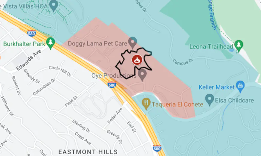
Map: Keller Fire in Oakland hills
The wildfire that started Friday in the hills of Oakland is about 5 miles from where a 1991 fire burned 1,520 acres and killed 25 people.
The wildfire that started Friday in the hills of Oakland is about 5 miles from where a 1991 fire burned 1,520 acres and killed 25 people.
The Keller Fire (indicated by the red fire icon on the map above) was reported around 1:30 p.m. on Oct. 18 at the end of Sanford Street. Evacuation orders were issued within about half an hour and eventually covered 1½ square miles.
As of Sunday afternoon, Oct. 20, the fire had been held to 15 acres and the evacuation order had been lifted for all but a small area, shown as a red tint on the map.
The approximate area of the 1991 Oakland Hills fire is shown in gray, with the black fire icon. That fire started on Oct. 19.


What's Your Reaction?