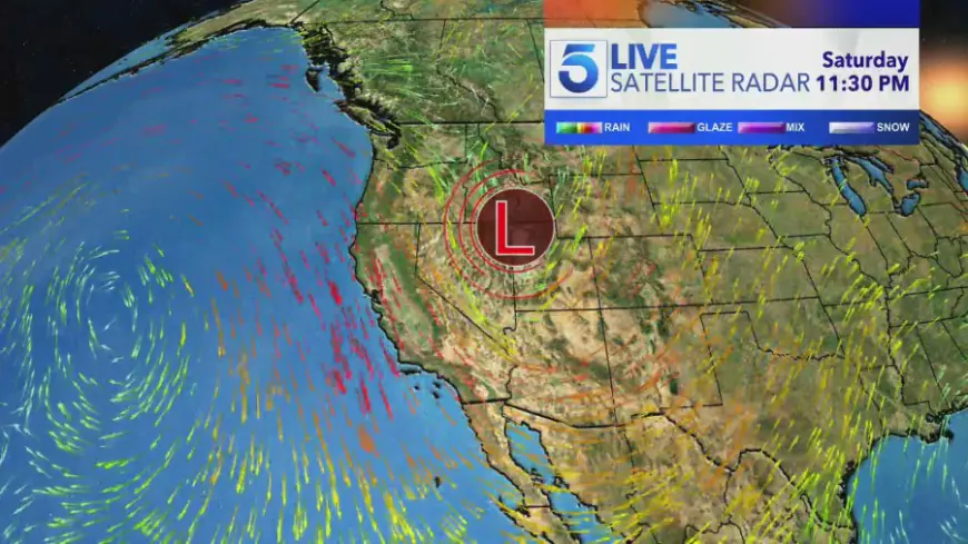
Low pressure system churning in Pacific Ocean could lead to substantial rain in Southern California
A low pressure system in the Pacific Ocean could bring some substantial rainfall to Southern California this weekend. That weather pattern, known as zonal flow, is why SoCal has seen average and slightly above average temperatures this week, KTLA 5 meteorologist Henry DiCarlo explained. “Keep in mind, in this time of year, we can generally [...]

A low pressure system in the Pacific Ocean could bring some substantial rainfall to Southern California this weekend.
That weather pattern, known as zonal flow, is why SoCal has seen average and slightly above average temperatures this week, KTLA 5 meteorologist Henry DiCarlo explained.
“Keep in mind, in this time of year, we can generally get warm weather or get much cooler weather, and we’re right around the average...the reason for that is zonal flow,” Henry said. “It’s slightly cooler because the air starts from the north and takes a turn, so we’re not bringing in warm air or aggressively cold air.”
A high pressure system currently over the southwestern U.S. will be affected by the trough; however, the extent of how much precipitation will fall is still up in the air.
“What we get is this area of low pressure which during the summer months, typically stays to the north, but now since the jet stream has moved a little bit, the high pressure starts to weaken,” Henry elaborated. “It’s going to open the door [for rain] but the question is how [wide] the door is open.”
If the low pressure system moves down the western seaboard and hovers over California and Nevada – as some computer models project – that could pave the way for as much as two to three inches of rain this weekend.
That said, if the high pressure system continues to hold through Wednesday and Thursday, the chance of precipitation falls significantly.
“If the high pressure that we have today and tomorrow stays with us and is strong enough to bump the low pressure system just a couple hundred miles to the east, we will get shut out,” Henry said.
In their latest regional forecast, the National Weather Service stated that the storm’s trajectory is still “highly uncertain,” but can bring the possibility of rain, high-elevation snow and gusty winds.
As for the rest of the workweek, it will be dry across most of the region, NWS says. Warm temperatures and clear skies should provide for a comfortable Halloween trick-or-treating experience on Thursday night.
What's Your Reaction?


