Cool Starts and Comfortable Afternoons Rest of Week
A change is in the air the rest of this week across South Florida as the cold mornings turn less intense and the afternoons become...
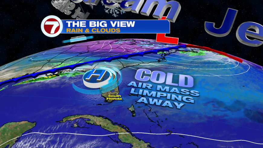
A change is in the air the rest of this week across South Florida as the cold mornings turn less intense and the afternoons become warmer but still comfortable.
It still was cold across much of the area this morning, however, with widespread lows in the 50s across inland areas and even along the Broward County coast.
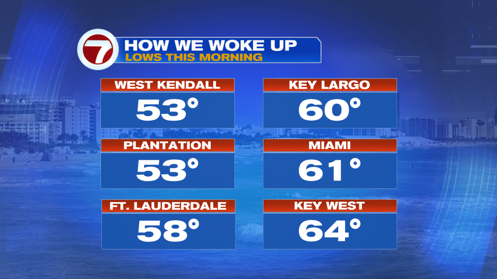
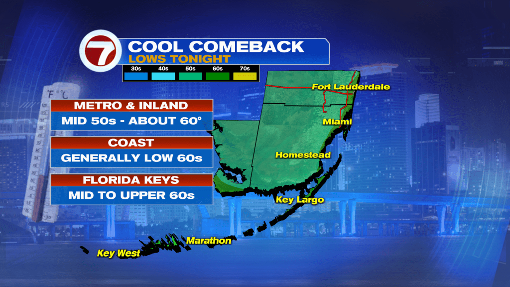
Tomorrow morning will be quite similar with lows in the 50s and 60s — still below average.
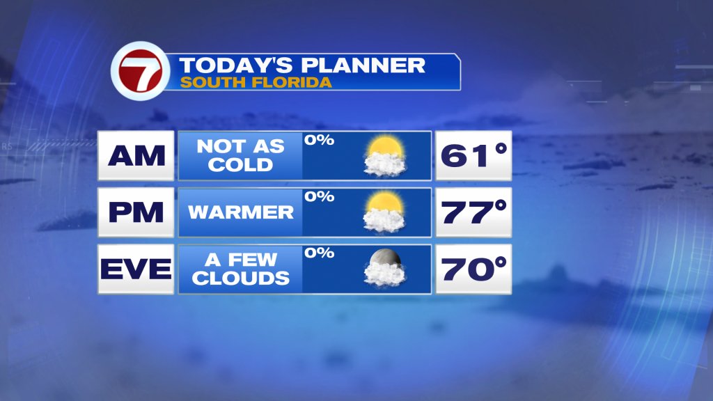
For our Thursday, high temperatures will be warmer into the mid to upper 70s under a mix of sun and clouds.
Friday will then be a tad even warmer with highs around 80F as we watch our next front move through.
This front will arrive late Friday evening but this time it won’t drop temperatures much. Instead, it will reinforce the mild and pleasant air mass through early next week.

Behind this front will be a continuation of the dry conditions with times of sun and clouds.
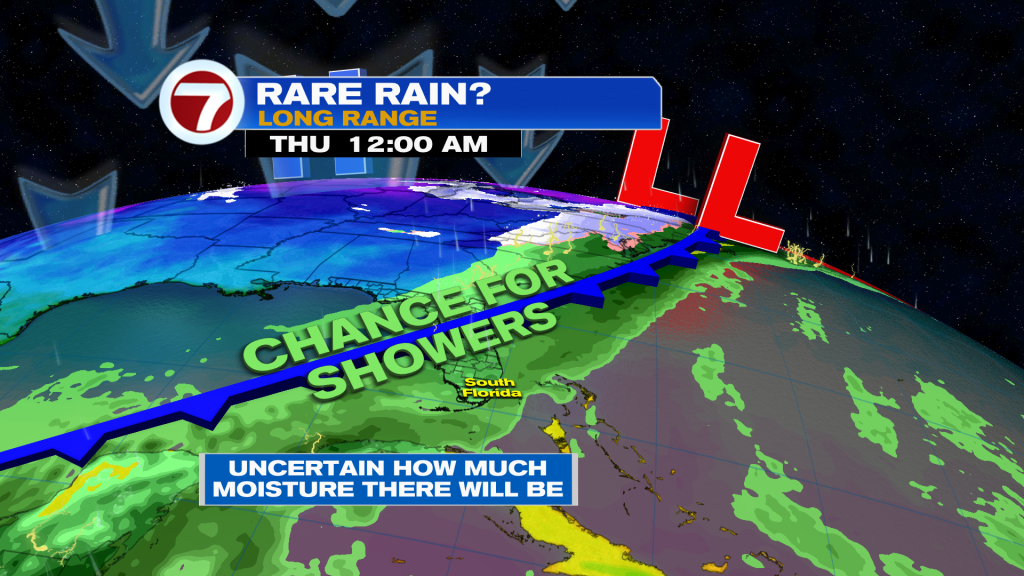
Eventually by the middle of next week in the long range, another front will approach and this one could stir up some moisture, leading to a rare rain chance. Currently the odds of seeing rain are low but we’ll have to wait and see how this evolves.
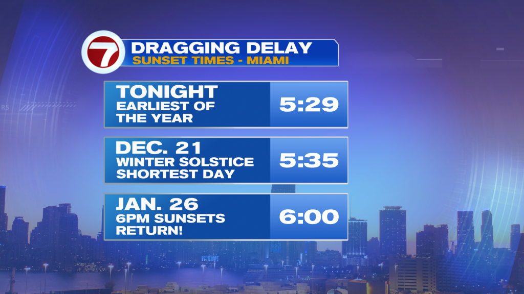
By the way, this evening will feature the latest sunset of the year before we start to notice later sunsets develop once again going forward!
What's Your Reaction?


